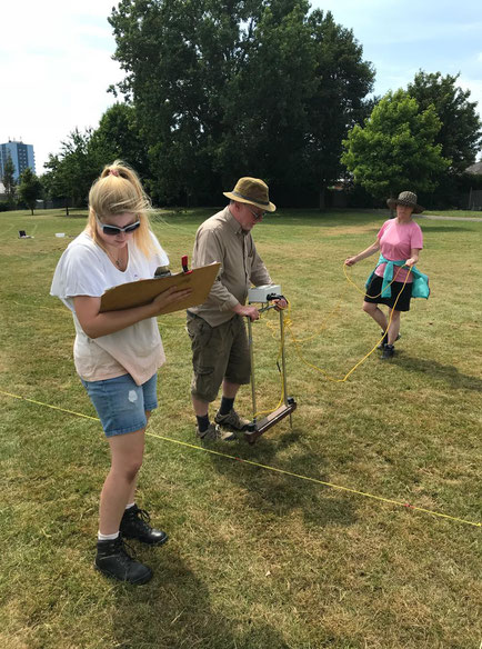
Today, we were joined by Jonathan Thomas, who taught some of our members and volunteers how to use his twin-probe resistance meter to conduct an electrical resistance geophysical survey of the KGV playing fields, while our other members continued to excavate. Resistivity surveys are conducted using a resistance meter, which passes an electrical current through the ground and logs the results.
We conducted this geophysical survey in order to provide more information about the potential archaeology at the KGV playing fields, which will form the basis for our further excavation work at this site.
The Survey
To complete the geophysical survey, we first had to set up a survey grid in the field, so that the end results are tied into an exact known geographical area. When this grid was complete and accurate, we then walked in transects within the grid, taking resistivity readings at regular intervals. Alongside the digital record of the results logged within the resistance meter itself, we also kept a paper record of the results.
AiM would like to thank Jonathan once again for his time and teaching. Everybody involved had a brilliant day learning about the methodology of the geophysical survey techniques, and enjoyed being able to put these new skills into practice!
For more photographs of our excavations, please see our Facebook page!
Write a comment